
We have developed an Environmental Oil Spill Sensitivity Atlas covering West Greenland off shore waters and coastal areas particularly sensitive to oil spills. The Atlas has been prepared to provide oil spill response planners and responders with tools to identify resources at risk, establish protection priorities and identify appropriate response and clean-up strategies. The atlas enables oil companies and authorities to incorporate environmental consideration into exploration and contingency plans.
The atlas provides an overview of such aspects as the occurrence of wildlife, human resource use (fishing and hunting) and archaeological sites that are particularly sensitive to oil spills. Furthermore it contains information regarding the physical environment – coastal types, oceanography – logistics and oilspill response methods.
Solid information on maps
The information derives from numerous scientific studies and from local knowledge achieved from interviews with local fishermen and hunters in almost all settlements within the mapped region. The coast is divided into segments of app. 50 km length, and each segment is classified according to its overall sensitivity to marine oil spills. The informations are collated on two main sets of digital charts:
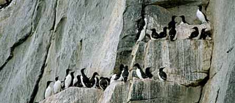
Shoreline sensitivity maps shows index values for coastal sensitivity and symbols for the significant elements of the classification (hunting and fishing areas, fish, birds, marine mammals and archaeological sites). Each map has a description of biological resources and human use of the area.
Physical environment and logistic maps shows coast types, logistics and proposed methods to oil spill response for each area.
The atlas consists of four parts covering the following areas:
South Greenland region 58°-62°N (pdf file, 97 MB)
West Greenland region 62°-68°N, Part 1 and Part 2 (pdf file)
West Greenland region 68°-72°N (pdf file, 135 MB)
Northern West Greenland 72°-75°N (pdf file)
Northern West Greenland, Baffin Bay 75°-77°N (pdf file)
The atlas is developed collaboratively by a number of Greenlandic and Danish institutions headed by the National Environmental Research Institute. The atlas is financed by the Greenland Home Rule Bureau of Minerals and Petroleum and The Danish Ministry of Environment, Danish Cooperation for Environment in the Arctic (Dancea).
Short presentation of the atlas (Environmental oil spill sensitivity atlas of West Greenland ).
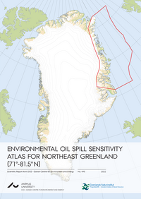
No. 495: Environmental Oil Spill Sensitivity Atlas for Northeast Greenland (71º-81.5º N). Clausen, D.S., Boertmann, D, Johansen, K.L., Potter, S., Myrup, M., Zinglersen, K.B & Mosbech, A. 2022. – Scientific Report from DCE – Danish Centre for Environment and Energy No. 495.
Summary | Eqikkaaneq | Sammenfatning | Report (105,70 MB)
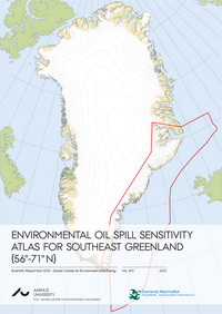
No. 492: Environmental Oil Spill Sensitivity Atlas for Southeast Greenland (56º-71º N). Johansen, K.L., Boertmann, D., Clausen, D.S., Kyhn, L., Potter, S., Myrup, M., Zinglersen, K.B. & Mosbech, A. 2022. Scientific Report from DCE – Danish Centre for Environment and Energy No. 492.
Summary | Eqikkaaneq | Sammenfatning | Report (129,41 MB)
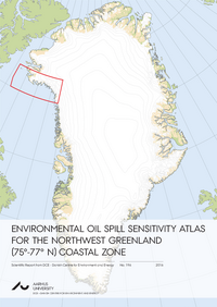
No 196. Environmental oil spill sensitivity atlas for the Northwest Greenland (75°-77° N) coastal zone. Clausen, D.S., Mosbech, A., Boertmann, D., Johansen, K.L., Nymand, J., Potter, S. & Myrup, M. 2016. Aarhus University, DCE – Danish Centre for Environment and Energy, 160 pp. Scientific Report from DCE – Danish Centre for Environment and Energy No. 196.
Summary | Sammenfatning | Eqikkaaneq | Report (41,57 MB)
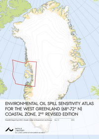
Nr. 44: Environmental Oil Spill Sensitivity Atlas for the West Greenland (68°-72° N) Coastal Zone, 2nd revised edition. Clausen, D., Johansen, K.L., Mosbech, A., Boertmann, D. & Wegeberg, S. 2012. Aarhus University, DCE – Danish Centre for Environment and Energy, 498 pp. Scientific Report from DCE – Danish Centre for Environment and Energy Nr. 44.
Summary | Resume | Hele rapporten i pdf-format (38,44 MB)
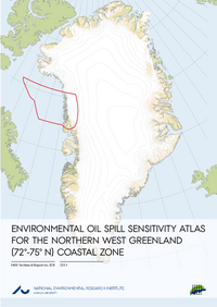
No. 828: Environmental Oil Spill Sensitivity Atlas for the Northern West Greenland (72°-75° N) Coastal Zone. Stjernholm, M., Boertmann, D., Mosbech, A., Nymand, J., Merkel, F., Myrup, M., Siegstad, H., Clausen, D. & Potter, S. 2011. National Environmental Research Institute, Aarhus University, Denmark. 210 pp. – NERI Technical Report No. 828. Summary | Sammenfatning | Eqikkaaneq | Full report in PDF-format (10,2 MB).
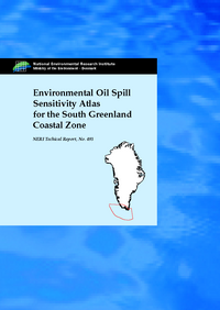
Nr. 492: Environmental Oil Spill Sensitivity Atlas for the South Greenland Coastal Zone - between 56°30' N and 62° N. Mosbech, A., Boertmann, D., Olsen, B.Ø., Olsvig, S., von Platen, F., Buch, E., Hansen, K.Q., Rasch, M., Nielsen, N., Møller, H.S., Potter, S., Andreasen, C., Berglund, J. & Myrup, M., 2004. Summary | Full report in pdf format Acrobat Reader 6 (102,704 kB).
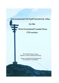
Environmental Oil Spill Sensitivity Atlas for the West Greenland Coastal Zone (62°-68° N) Coastal Zone. Stjernholm, M., Boertmann, D., Mosbech, A., Nymand, J., Merkel, F., Myrup, M., Siegstad, H., Clausen, D. & Potter, S. 2000. National Environmental Research Institute, Aarhus University, Denmark. Chapter 1-8 | Chapter 9 -16 in PDF-format (10,2 MB).
